
-
 Korea.net's 24-hour YouTube channel
- NEWS FOCUS
- ABOUT KOREA
- EVENTS
- RESOURCES
- GOVERNMENT
- ABOUT US


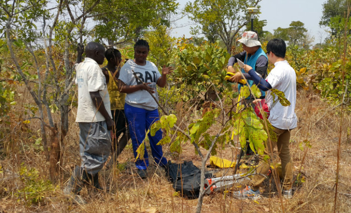
The National Geographic Information Institute (NGII) staff delegated to Zambia take measurements of ground control points for geological and mining information.
Plans have been announced for Korea’s spatial information technology to be used in the development of the land and resources in Africa.
For systematic management and exploitation of resources in the continent, the United Nations (U.N.), World Bank and African Union (AU) jointly initiated the demonstration project to establish a geological and mining information system for which Korea will provide spatial information technology. As a response to the U.N.’s request for cooperation, the National Geographic Information Institute (NGII) under the Ministry of Land, Infrastructure and Transport signed an MOU with Zambian Ministry of Mines and Minerals Development on Dec. 16.
Currently, massive amounts of natural resources found in Africa cannot be used for the development of the region. In order to solve the problem, the AU, a continental union consisting of 53 African nations, adopted African Mining Vision in 2009. In 2012, they set a specific goal to share geological and mining information.
Starting in Zambia, the project is set to expand to Mozambique and Tanzania. The NGII staff are already dispatched to the country to prepare for the establishment of the geological and mining information system.
By Kim Young Shin
Korea.net Staff Writer
Photo: The National Geographic Information Institute
ysk1111@korea.kr
Most popular
- First hearing-impaired K-pop act hopes for 'barrier-free world'
- Expats could account for 7% of population in 20 years: report
- 'Mad Max' director impressed by 'cinema-literate' Korean viewers
- Show in Italy to present 'thought-filled' Korean craftworks
- Romanian presidential couple visits national cemetery


KOREA.net
Copyright © Ministry of Culture, Sports and Tourism