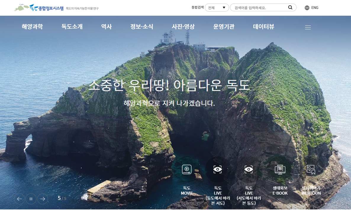
The Ministry of Oceans and Fisheries on Aug. 6 launched a real-time video service for viewing Dokdo Island through the Dokdo Information System (www.dokdo.re.kr). (Screenshot from Dokdo Information System)
By Kim Hyelin and Joung Haseung
A new video service allows real-time viewing of the nation's easternmost island of Dokdo anywhere and anytime.
The Ministry of Oceans and Fisheries on Aug. 6 opened the service through the Dokdo Information System (www.dokdo.re.kr), a website with general information on the island run by the Korea Institute of Ocean Science and Technology. The site covers a wide scope of data on Dokdo including its science and history.
The service features the landscape of Dokdo. Those who wish to visit the island in person can also refer to weather forecasts there through videos at passenger terminals to decide whether to travel there.
Previously, many instances occurred in which visitors traveled long hours on passenger ships only to discover that Dokdo's weather was unstable when nearing the island and had to turn around. Even if they landed on the island, a full tour was impossible due to their trips being cut short.
Since last year, the ministry has sought to install systems to provide video footage of Dokdo's eastern islet Dongdo and its western one Seodo to enhance visitor convenience and safety. The tasks of adding equipment and connecting networks were completed last month.
Kim Wansu, director of the ministry's Marine Territory Division, said, "Through this real-time video service for Dokdo, we hope to widely promote the island's value as a tourism resource."
This service is also available on the official website of Ulleung-gun County, Gyeongsangbuk-do Province: (http://www.ulleung.go.kr/ko/main.htm). The county is home to Ulleungdo Island, which is the closest domestic island to Dokdo.
kimhyelin211@korea.kr
Most popular
- Grammy-winning producer calls Suga of BTS 'amazing artist'
- 'Universal love, family' themes fuel success of 'King of Kings': director
- Council sets minimum hourly wage in 2026 at KRW 10,320
- Expansion of foreign app system raises tourist convenience
- Nat'l population diversity rose nearly 8% from 2018-22: study