- 한국어
- English
- 日本語
- 中文
- العربية
- Español
- Français
- Deutsch
- Pусский
- Tiếng Việt
- Indonesian
By Honorary Reporter Foteini Chatzoudi from Greece
Photos = Jenni Sparks
Jenni Sparks, a U.K.-based illustrator and cartographer, brings Seoul's cityscape to life through her hand-drawn map. Since making a similar map of London in 2012 that proved popular, she has made intricate illustrations of major cities worldwide including New York, Berlin, Sydney and Melbourne in Australia, and San Francisco.
Her work has attracted collaborations with global brands like Nike, Adidas, McDonald's France, Los Angeles Times, Cosmopolitan, Google and Time Out.
The following excerpts are from an email interview with Sparks from April 14-16.
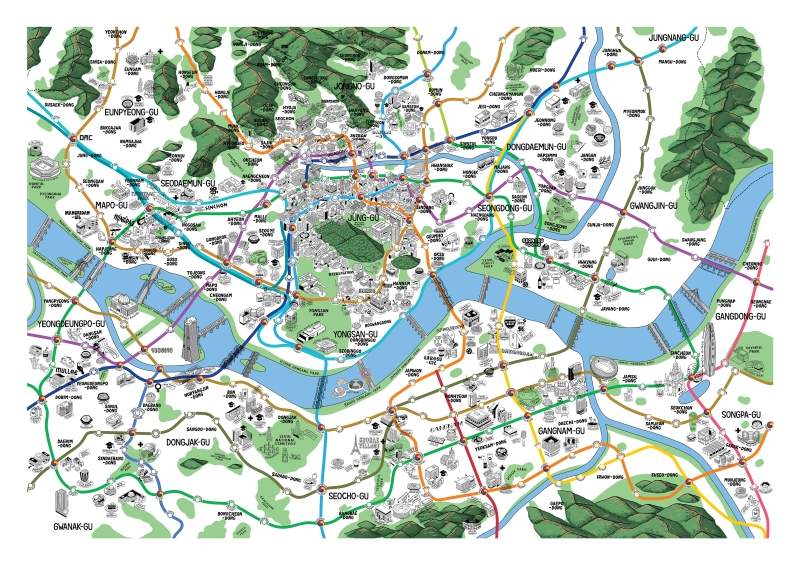
Jenni Sparks' Seoul map (work in progress)
How did you start out as a map illustrator and what drew you to Seoul?
In 2012, fresh out of university, I received my first commission from Evermade to create a unique London map during the Summer Olympics and Queen's Jubilee. People were drawn to the humor in my work, and the map's viral success in U.K. media launched my career as a cartographer. For Seoul, I began with the central area around Namsan Mountain and Myeong-dong as a demonstration piece, drawn to the area's beauty and vibrancy.
What makes Seoul unique in your eyes and how do you maintain accuracy?
As my first Asian city map, Seoul presents unique characteristics. The city's mountainous geography, distinct architecture blending modern and traditional elements, and abundance of fresh produce markets required adapting my style. While achieving perfect accuracy is challenging, I conduct extensive research using various sources and consult with locals. I view my maps as time capsules of established landmarks.
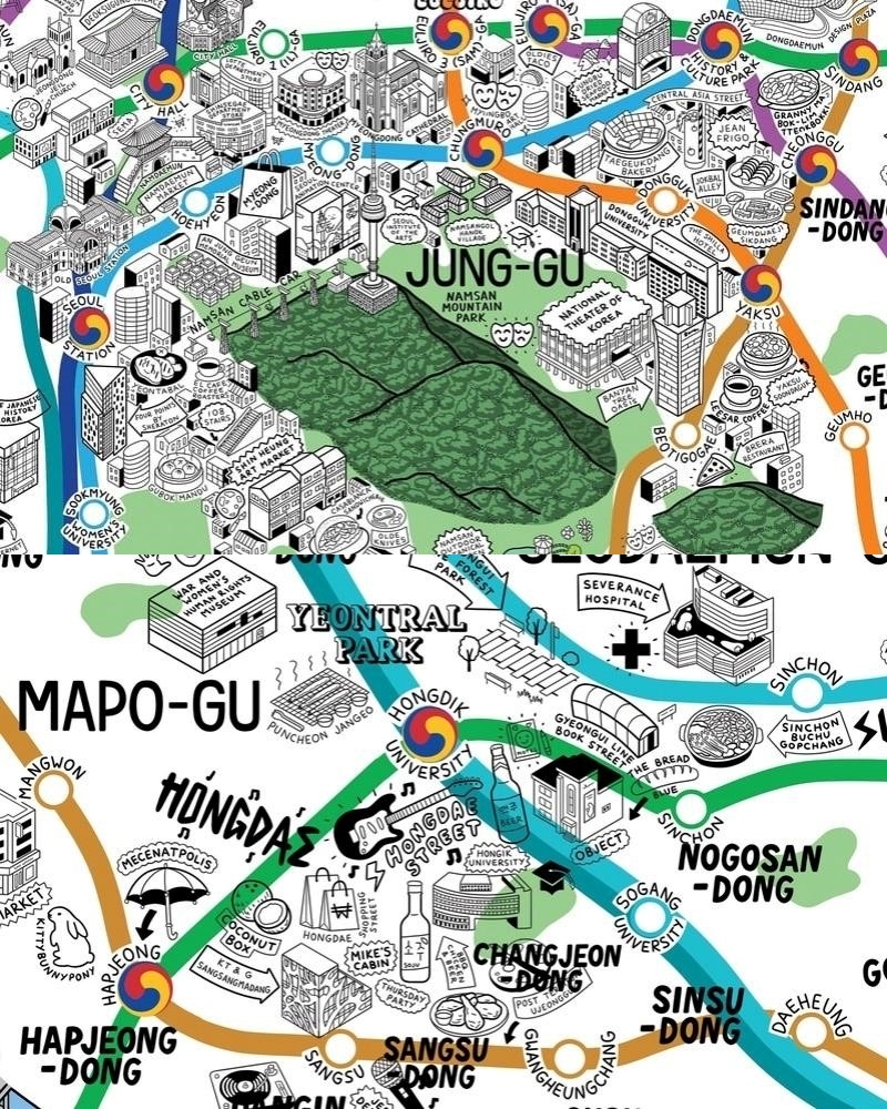
Detail views of the Seoul map showing the Namsan area (top) and Hongdae area (bottom)
Describe your creative process and challenges.
The journey begins with months of cultural and city research. I start mapping geographical elements like rivers and mountains, followed by the subway system. After plotting neighborhoods and landmarks, I add residential buildings and finally conduct a thorough editing process with local input. The Seoul map will take approximately a year to complete.
The mental challenge of capturing an entire city is daunting. Converting 2D references into 3D illustrations that match the map's style is particularly demanding, more so than my other illustration work.
What are your favorite aspects of the Seoul map and plans?
Currently, the areas around Namsan Mountain and Hongdae are my favorites for their vibrant atmosphere. After completing the Seoul map, I plan to take a break and focus on personal projects, including possibly mapping Bristol, my home city. I'm also interested in creating travel diary illustrations of other Korean cities, particularly Jeju Island and Busan.
msjeon22@korea.kr
*This article is written by a Korea.net Honorary Reporter. Our group of Honorary Reporters are from all around the world, and they share with Korea.net their love and passion for all things Korean.