A new highly-detailed three-dimensional map of the Korean Peninsula has been created.
The National Geographic Information Institute (NGII) recently announced that its newly-launched Digital Elevation Model (DEM) can provide three-dimensional geographic information about the entire Korean Peninsula. A DEM is a digital three-dimensional representation of a terrain's surface that indicates the earth's height, omitting any further information, like buildings.
The grid spacing is about 90 meters, fine enough to see rough images of cityscapes, mountains and fields.
Previously, this technology wasn't made available to the general public. The new model, however, was designed to encourage use by private organizations. The Root Mean Square Error (RMSE) -- the difference between values predicated by the model and observed values -- is about 6.2 meters.
The data service is expected to be used across a wide array of fields, for instance, in the analysis of visibility and sunlight and in the production of multi-dimensional models.
The model can be downloaded free at the website of the NGII.
http://air.ngii.go.kr
By Lee Seung-ah
photo courtesy of the NGII
slee27@korea.kr

The National Geographic Information Institute (NGII) recently announced that its newly-launched Digital Elevation Model (DEM) can provide three-dimensional geographic information about the entire Korean Peninsula. A DEM is a digital three-dimensional representation of a terrain's surface that indicates the earth's height, omitting any further information, like buildings.
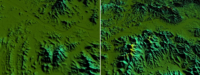
(Left) A Digital Elevation Model of Seoul shows the Hangang River flowing through the center of the city, embraced by Inwangsan Mountain to the north and Gwanaksan Mountain to the south. (Right) Daegu is located in a basin surrounded by mountains to both the south and the north, and the Geumhogang River flows in an east-to-west direction.
The grid spacing is about 90 meters, fine enough to see rough images of cityscapes, mountains and fields.
Previously, this technology wasn't made available to the general public. The new model, however, was designed to encourage use by private organizations. The Root Mean Square Error (RMSE) -- the difference between values predicated by the model and observed values -- is about 6.2 meters.
The data service is expected to be used across a wide array of fields, for instance, in the analysis of visibility and sunlight and in the production of multi-dimensional models.
The model can be downloaded free at the website of the NGII.
http://air.ngii.go.kr
By Lee Seung-ah
photo courtesy of the NGII
slee27@korea.kr
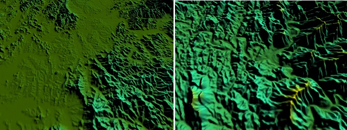
(Left) The plains around Naju in Jeollanam-do (South Jeolla Province). (Right) Yeongwol County in Gangwon Province is surrounded by the ridges of Taebaeksan and Sobaeksan mountains.
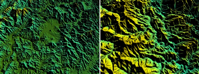
(Left) There is a large lake in Chuncheon City in Gangwon Province. (Right) Taebaeksan Mountain.
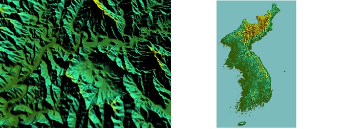
(Left) There are lakes and dams around Hwacheon County in Gangwon Province. (Right) The Korean Peninsula.
Most popular
- Grammy-winning producer calls Suga of BTS 'amazing artist'
- Animated 'KPop Demon Hunters' tops Netflix charts in 41 markets
- 'Squid Game' events to pump up K-Content Seoul Travel Week
- Reunited BLACKPINK releases video preview of world tour
- 'Universal love, family' themes fuel success of 'King of Kings': director