- 한국어
- English
- 日本語
- 中文
- العربية
- Español
- Français
- Deutsch
- Pусский
- Tiếng Việt
- Indonesian
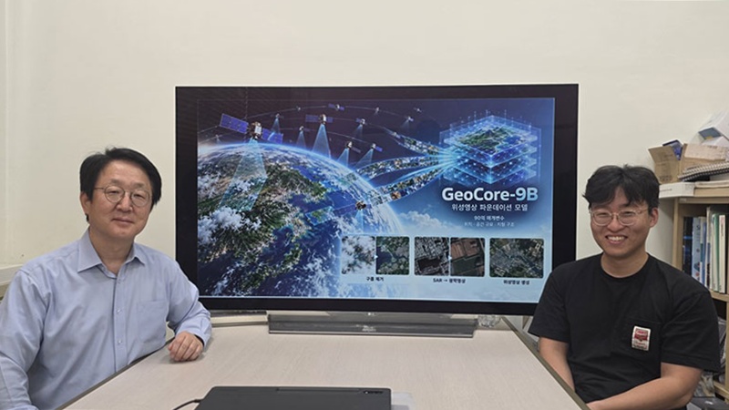
A research team at the Korea Advanced Institute of Science and Technology (KAIST) has developed GeoCore-9B, an artificial intelligence model for the generation, restoration and transformation of satellite imagery. Shown are professor Kim Munchurl (left) from KAIST's School of Electrical Engineering and the study's lead author Do Jeonghyeok sitting in front of a large screen displaying their team's achievements.
By Hong Angie
Photos = Korea Advanced Institute of Science and Technology (KAIST)
A research team has developed an artificial intelligence (AI) model that converts Earth observation satellite images obscured by clouds or represented as complex radar signals into clear, photo-like images.
The Korea Advanced Institute of Science and Technology (KAIST) on Oct. 20 said the team led by Kim Munchurl, professor at the university's School of Electrical Engineering, developed GeoCore-9B, which generates, restores and transforms satellite imagery.
Such imagery is essential for monitoring climate change and responding to disasters such as wildfires and floods. But optical satellites, which need visible light, cannot observe the ground when the weather is cloudy or dark.
In contrast, synthetic aperture radar (SAR), which observes the planet's surface by emitting radio waves, is not constrained by weather or time but its images can be difficult to interpret as they can differ in appearance from conventional photos.
Instead of modifying generative AI models for general-purpose photography, the team designed and trained a model from the ground up specifically for Earth observation data.
Its "foundation model" has about nine billion parameters trained on a dataset of 10 million pairs of global satellite imagery and corresponding descriptive text.
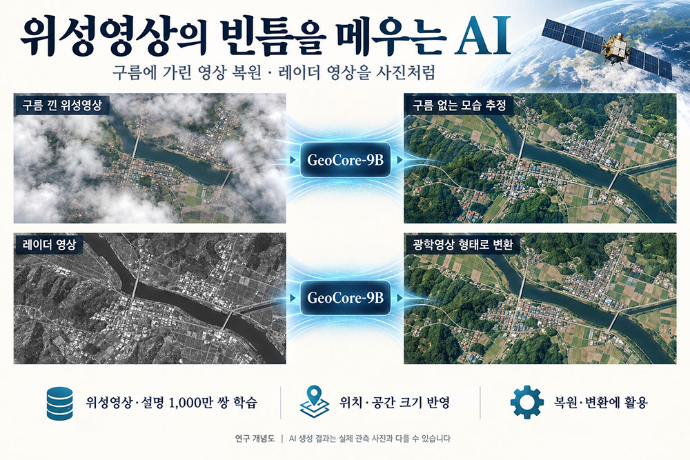
A conceptual diagram illustrates the restoration and transformation of satellite imagery by the KAIST-developed AI model GeoCore-9B.
By integrating not only the objects within the footage but also data such as capture location (latitude and longitude), ground sampling distance, which reflects ground-level dimensions, and information on topographical structures like road networks and agricultural field boundaries, the technology minimizes the distortion relative to the terrain.
In performance evaluations, GeoCore-9B showed reconstruction quality and accuracy superior to specialized models in both cloud removal experiments and the optical conversion of SAR imagery.
It also uses low-rank adaptation, a cost-effective optimization technique of adjustment to a subset of parameters rather than requiring retraining of the model from scratch.
"By training the AI to understand both the spatial positioning and actual physical dimensions of objects in satellite imagery, we've enabled one model to flexibly perform various tasks such as removing cloud cover and transforming image data," Kim said.
"This allows continuous and unobstructed observation even with adverse weather or at night, which will greatly help rapid disaster response, analysis of environmental changes and surveillance for national defense."
As head of KAIST's Information and Electronics Research Institute, Do was the lead author of this study, which was officially accepted for presentation at the Conference on Neural Information Processing Systems, the world's leading event of its kind on AI.
shong9412@korea.kr