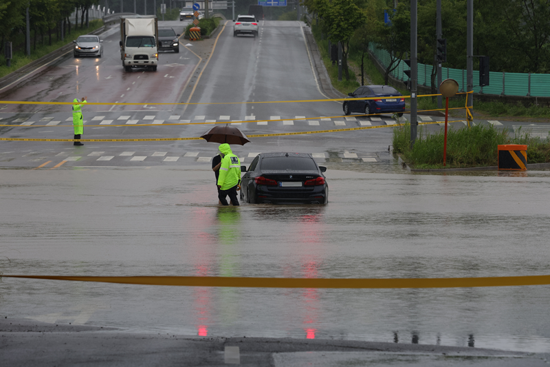
Drivers from this month can get flood alerts on the road through map apps or navigation systems. Shown is a police officer on the morning of July 18 escorting the driver of a car stuck in a flood to a safe place near Munsan Station in Paju, Gyeonggi-do Province. (Yonhap News)
By Hong Angie
Drivers from this month can receive real-time flood alerts like warnings of flooding or dam discharge via car navigation screens or audio guidance.
The Ministry of Science and ICT, in cooperation with the Ministry of Environment and Presidential Committee on the Digital Platform Government, on July 24 said that as of July 22, six businesses taking part in a project to advance navigation to prevent flood accidents on roads and underpasses completed updates for sending real-time flood alerts.
Kakao Navi on July 1 began its service, Hyundai Motor and Kia Corp. on July 4, Atlan on July 5, TMAP on July 10, Naver Map on July 11 and Inavi Air on July 22.
As their main services, these companies provide real-time data on risky situations such as flooding, inundation and road closures for driver safety.
Navigation systems, however, urge a driver of the need for more careful driving through awareness of nearby dangers through screen and voice, but does not give alternate routes.
To get flood alerts on certain navigation systems, updates to the latest versions of apps are needed. Users should also check that their systems are up to date.
"Providing flood alert information via navigation is a good example of utilizing digital technology based on private-public cooperation to protect public safety and solve social issues," said Uhm Yul, director-general of the Science Ministry's Information and Communications Policy Bureau.
"We'll do our best to actively seek the use of digital technology felt by the public and integrate the capabilities of the government and private companies."

Screen shots of Naver Map and Kakao Navi (Ministry of Science and ICT)
shong9412@korea.kr
Most popular
- Slew of festivals, events scheduled in downtown Seoul in May
- Actor Tom Cruise proves 'love for Korea' with 12th visit
- Netflix releases official trailer for final season of 'Squid Game'
- Jeju Island completes prep to host series of APEC meetings
- Korea Day celebrated at Osaka-Kansai World Expo in Japan