
-
 Korea.net's 24-hour YouTube channel
- NEWS FOCUS
- ABOUT KOREA
- EVENTS
- RESOURCES
- GOVERNMENT
- ABOUT US

Despite the record heavy rainfall, however, Korea’s largest island did not suffer from much rain damage. Experts agree that this was due to the unique geological structure of Jeju Island, which prevented the island from facing large amounts of damage. As a volcanic island, the soil layers of Jeju are evenly mixed with volcanic rock, volcanic ash, sand and gravel, allowing rainwater to easily soak into the ground.
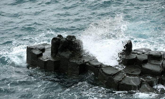
The bottom of the entrance to the Seongsan Ilchulbong is covered with basalt. Basalt can be easily found on Jeju Island, reminding visitors that the island was created through volcanic activity.
The Dol Hareubang, the human-shaped statues of Jeju Island, and the black volcanic stone walls of the island are both made from basalt, a type of volcanic rock with a porous surface mostly made during volcanic activity. Apart from basalt, many other results of volcanic activity of the past can be seen across the island, including crossed section of strata, oreum, or tiny volcanic zones that contain a volcanic cone, lava caves and gumburi, or volcanic craters.
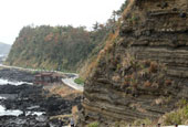
Traces of volcanic activity can be clearly seen in rock strata. A perfect example is at the Suwolbong Volcanic deposits. Located at Gosan Port, on the southern part of the island, these rocks show a large area of cross-sectioned strata adjacent to the beach. The soil layers show both sedimentary layers and other layers stacked up due to volcanic activity. By looking closely, volcanic rock pushed by the explosion of an underwater volcano are stuck in the soil deposits, penetrating other layers. This demonstrates how intense the volcanic activity was.
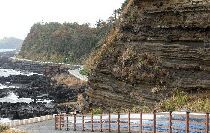
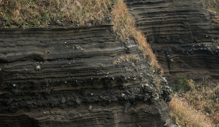
The Suwolbong Volcanic deposits near Gosan Port on Jeju Island show volcanic rock that has penetrated the higher soil levels due to the force of the explosion of an underwater volcano.
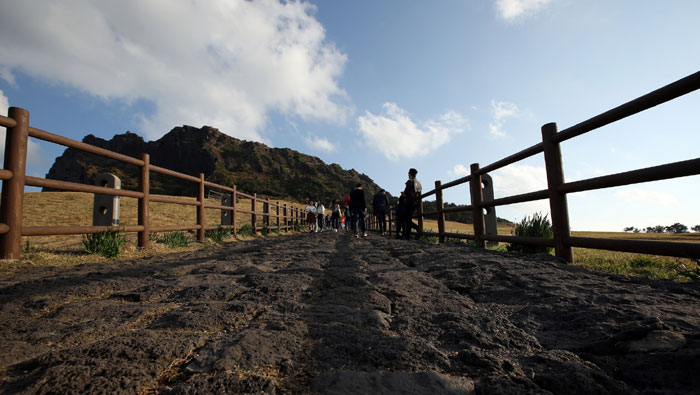
Traces of volcanic activity can be seen across the island on its walking and hiking trails. While following the Olle trekking path, an iconic network of walking trails across the island and one of its largest tourist attractions, people can see various colors of soil ranging from black to red. Black soil symbolizes basalt made during the rapid cooling process of lava. Red soil, known as scoria, is the outcome of volcanic ejecta, rocks, ash and subterranean gases. Trekkers can see various beach shapes while walking along the trails, ranging from white sandy beaches to black sand, due to the volcanic activity of the island.
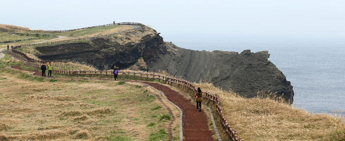
While walking along the Olle trails, people can see various colors of soil and the plants living in it.
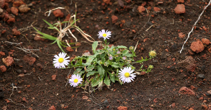
A wild flower grows in the red soil of Jeju Island. The red soil is known as scoria, an outcome of the volcanic ejecta and other gases.
The columnar joints of the Jusangjeolli Cliffs at the Jungmun Tourism Complex can be seen on Jeju Island. These columnar joints are created by basaltic lava flow.
Volcanic activity creates many picturesque places. The Jusangjeolli Cliffs, part of the Jungmun Tourism Complex on the southern part of Jeju Island, has a scenic view and is characteristic of the island province. The cliffs have columnar joints which look like a folding screen composed of tetragon- or hexagon-shaped pillars. These columnar joints are created when thick basaltic lava at about 1,000 degrees Celsius flows from the mouth of a volcano and cools rapidly. The columnar joints of the cliffs are 30-40 meters tall and extend for about 1 kilometer, the largest such natural formation in Korea.
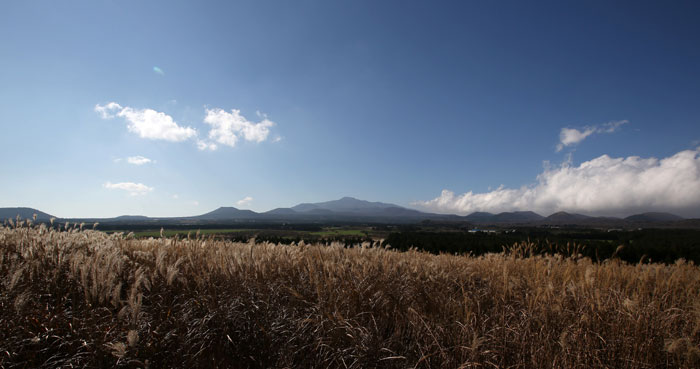
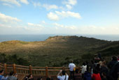
Hallasan Mountain on a sunny day. This 1,950-meter dormant volcano is the center of Jeju Island.
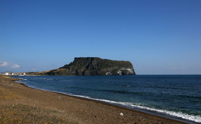
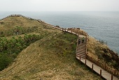
Located off the eastern tip of Jeju Island, the Seongsan Ilchulbong is created by the explosion of an underwater volcano. This is also one of the oreum, or tiny volcanic zones, scattered across the island.
Other unmissable evidence of volcanic activity on Jeju Island are Hallasan Mountain, the Seongsan Ilchulbong and the system of underground lava caves.
Hallasan Mountain is the central mountain of the island and is the top of a shield volcano. This mountain, 1,950 meters high, is the representative outcome of the fourth stage of volcanic activity that took place in the oceans surrounding the Korean Peninsula.
The Seongsan Ilchulbong is an oreum created during the explosion of an underwater volcano. It shows the birth and growth of a Surtseyan eruption, a type of volcanic eruption that takes place in shallow seas.
The lava cave system was created when basaltic lava flow ran toward the ocean between 300,000 and 100,000 years ago. Today, nine caves have been found, including the Manjanggul Cave.
The Manjanggul Cave is 7.4 kilometers long, can be as wide as 23 meters and can stretch up to 30 meters in height. This is the finest and largest cave among the Geomunoreum lava cave system. The Manjanggul Cave shows well-preserved lava caves. Inside the caves, the flow lines of lava can be seen on the surface and the walls.
Jeju Island also has 368 oreums each of which has a small volcanic cone. Sangumburi is the largest and deepest oreum among them. It is 120 meters high and 2 kilometers deep, with a diameter of 500 meters. It is the world’s only flatland crater.
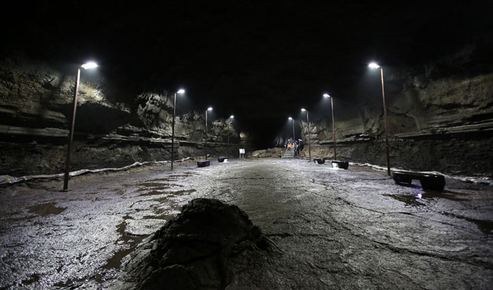
The Manjanggul Cave is the largest lava cave on Jeju Island. It is 7,416 meters long, as wide as 23 meters and reaches heights of 30 meters.
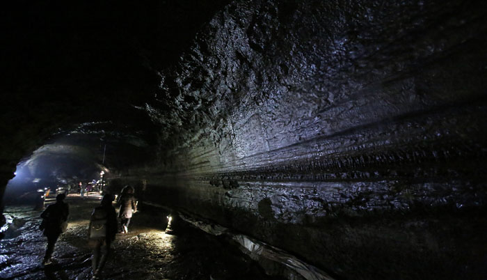
Lava flow lines can be seen along many parts of the Majanggul Cave.
UNESCO has recognized Jeju Island's volcanic geological features and its value to humanity. In 2010, it designated nine areas, including Hallasan Mountain, the Manjanggul Cave, the Seongsan Ilchulbong and the Suwolbong Volcanic deposits, as one of its Global Geoparks. Four years later, in September 2014, UNESCO added three more areas, including Biyangdo Island and Udo Island, to the list of Jeju's Global Geoparks.
Article by Yoon Sojung
Photos: Jeon Han
Korea.net Staff Writers
arete@korea.kr
Related Contents
Most popular
- First hearing-impaired K-pop act hopes for 'barrier-free world'
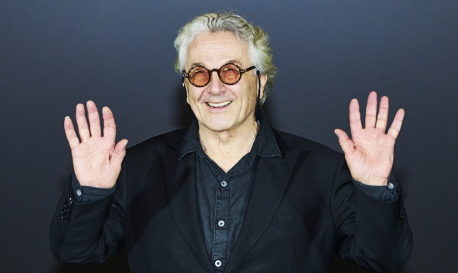
- 'Mad Max' director impressed by 'cinema-literate' Korean viewers
- Romanian presidential couple visits national cemetery
- President Yoon, Japan PM pledge better trilateral ties with US
- President, Romania pledge better defense, nuclear power ties